


The two cities of Leticia in Colombia and Tabatinga in Brazil are just 20 minutes away on foot via the Avenue of Friendship (Avenida de la Amistad) that connects them. In addition to the permanent cultural, economic, and social exchange, both cities benefit from the groundwater of the transboundary aquifer system of the Amazon.
But how is groundwater used to supply the populations of both cities? How is the water abstraction system built to access these waters? What are the conditions of quality and depth in which the waters are found? How vulnerable is the transboundary aquifer to pollution?
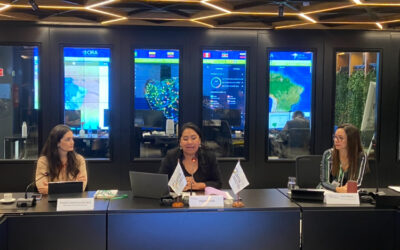
Since 2015, the Amazon Cooperation Treaty Organization (ACTO) has been investigating the transboundary aquifer Tabatinga-Leticia to consolidate information that might help answer the previous questions and advocate the sustainable management of these resources in the region. Currently (from July 2022 to July 2023), the study of “Hydrogeological evaluation of the vulnerability and risk in the development of policies on protection and water usage in the transboundary region of Leticia (Colombia) and Tabatinga (Brazil),” is being carried out in the framework of the Amazon Basin Project, executed by ACTO.
This hydrogeologic study consists of various steps that help understand how groundwater flows and is stored in the transboundary aquifer, as well as the quality and depth conditions, main threats, and necessary actions to protect these resources as a source of water for the region’s population. Therefore, community support and involvement from different social actors are essential to advance the study and promote participatory management through the project.
The objectives of the hydrogeologic evaluation are to update the baseline demand for groundwater using information obtained from a list of water points in Leticia and Tabatinga. This information is essential for gaining public support for the evaluation.
A groundwater quality and levels monitoring network will also be designed, which will facilitate both countries in identifying joint measures that must be taken to protect groundwater.
The project aims to update the risk assessment of contamination of the binational aquifer. In this regard, the population needs to comprehend the sources of pollution near the abstraction, which is why it is important to pay attention to the invitation for the upcoming regional workshop of the project, where the results regarding this area will be presented.
Through this study, the Amazon Basin Project also plans to define a strategy for mitigating the risks identified and determine a set of local guidelines for the use and protection of groundwater sources.
These inputs will allow the development of technical guidelines at the binational level, essential for the sustainable management of groundwater resources to protect these resources for the benefit of current and future generations.
The technical team conducting the study is the consulting firm, Servicios Hidrogeológicos Integrales (SHI-SAS) from Colombia, composed of engineers, geologists, and environmental professionals, who conducted the initial characterization of the binational aquifer system in 2015.
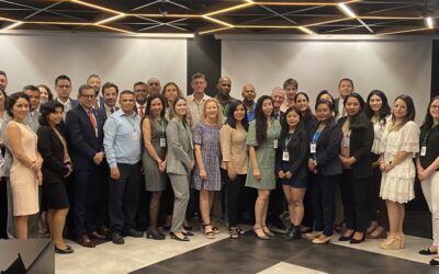
It should be noted that this study is being conducted by the coordination of the Binational Monitoring Group, made up of specialists from the Ministry of Environment and Sustainable Development of Colombia and the National Water and Basic Sanitation Agency (ANA) of Brazil, and has strategic actors in both countries, such as the Institute of Hydrology, Meteorology, and Environmental Studies (IDEAM) and the Corporation for the Sustainable Development of the Southern Amazon (Corpoamazonia) of Colombia, and on the part of Brazil, the Tabatinga City Hall: Secretary of the Environment, the Amazonas Sanitation Company (COSAMA), the Federal Institute of Education, Science, and Technology of Amazonas, and the Tabatinga Higher Studies Center of the Amazonas State University. These allies will help obtain significant results on the binational aquifer.
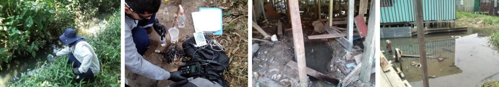
Collection and analysis of water samples and wastewater discharges, Leticia, Source: SHI SAS-15-09-2022.
Study Area for Aquifer Assessment
The study area comprises the urban area and part of the suburban area of Leticia and the urban area of Tabatinga. The municipality of Leticia has an area of 5,968 km2, a population of 42,280 people (2018 Census), and is located to the south of the Amazonas Department, on the left bank of the Amazon River, on the border between Colombia, Peru, and Brazil. The surface of the research area is 50 km2. Tabatinga has an area of 3,239 km2, with 20.5 km2 being the object of research for this evaluation. It is located at the western end of the state of Amazonas, on the banks of the Amazon River. In 2018, the population of the municipality was 65,844 inhabitants according to the Brazilian Institute of Geography and Statistics (IBGE, 2022).
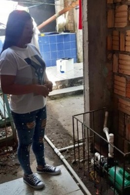 Claudia Silva, 34 years old, is a beneficiary of the project. She has a drinking water supply at her house in Leticia, Colombia, (see the picture above). When contacted by the SHI team, she expressed that she is very happy to learn about the quality of the water she uses through the program, and according to the results found, she will be able to take the necessary measures to improve the quality of water in her well.
Therefore, inventory updates of groundwater points in the research area are essential, since the information is obtained through door-to-door surveys.
In Colombia, the “Formato Único Nacional de Inventario de Puntos de Agua Subterránea (National Unique Format for Inventorying Groundwater Points)” (FUNIAS), designed by IDEAM, INGEOMINAS, and the Ministry of Environment and Sustainable Development (Minambiente), and for inventory in Brazil, the “Cadastro de Fontes de Abastecimento por Águas Subterrâneas (Registry of Groundwater Supply Sources)” format, supplied by ANA (National Water and Basic Sanitation Agency), is used.
Both formats include information on the physical characteristics of the water point, field physicochemical parameters, groundwater level, characteristics of the abstraction, the uses and the users, and sanitary conditions of the abstraction and its surroundings.
Based on the already inventoried wells (121 in Tabatinga / 226 in Leticia), the expansion of the inventory seeks to broaden the information on new wells in the transboundary aquifer system at a minimum of 54 points (25 with the database provided by ANA Brazil, and 29 wells with concession granted by Corpoamazonia in Colombia).
The inventory of groundwater points allows for the measurement of water levels, diagnosis of intake sanitation, identification of potential sources of nearby contamination, and updating of the demands for groundwater in the region based on data on water use and users.
For more information on the progress of activities in the Colombia-Brazil transboundary aquifer, please refer to the Amazon Waters Bulletin of the Amazon Basin Project.