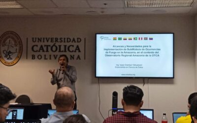
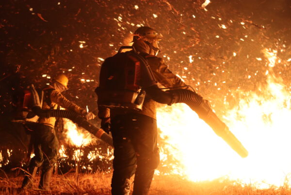
In an effort to intensify the fight against forest fires in the Amazon region, experts from ACTO member countries have proposed the creation of a Technical Group specialized in satellite image processing. This initiative arose during the International Seminar on Satellite Monitoring of Forest Fires, held from July 1 to 4 at the Graduate School of the Bolivian Catholic University "San Pablo", in Santa Cruz de la Sierra.
The event, promoted by the Amazonia+ Program, aimed to strengthen the capacities of Amazonian countries in the prevention, control and fight of forest fires through satellite monitoring. During the seminar, participants gained skills in advanced remote sensing and spatial analysis techniques, essential to the efforts of the Amazonia+ program.
The seminar sessions addressed key concepts and tools for forest fire monitoring and reporting, including satellite image processing, the use of online platforms and programming languages. Methodological approaches for mapping burned areas on a national and regional
scale using medium-resolution satellite data, such as those provided by Landsat 8-9 and Sentinel 2-1, were also presented.
One of the most prominent topics was the use of the Google Earth Engine tool for the detection of scars or burned areas through the processing of satellite images. This platform allows access to satellite image banks and programming tools, facilitating the processing
and generation of reports quickly and efficiently.
Isaac Ocampo, Data Science specialist at the Amazon Regional Observatory (ORA) of ACTO, highlighted the importance of this activity for the ORA and in the context of the Amazon Network for Integrated Fire Management (RAMIF). At the conclusion of the
seminar, the creation of a Technical Table of Experts in Satellite Image Processing for the study of forest fires was proposed. This technical group would generate maps on the burned areas in the Amazon, including current studies, historical maps, and future predictions,
through the collaborative work of experts from the official institutions of the eight member countries.


