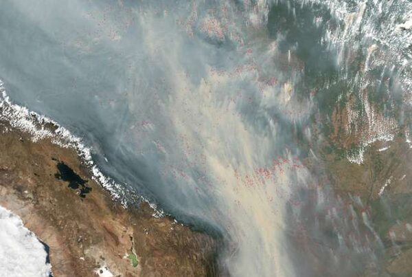
The Amazon Regional Observatory (ARO), of the Amazon Cooperation Treaty Organization (ACTO), has launched a new burned area monitoring module for the Amazon, covering the period from 2001 to 2025. The new tool provides a historical analysis of so-called “fire scars”—areas that have experienced fire events—and reveals a significant drop in the affected area between 2024 and 2025.
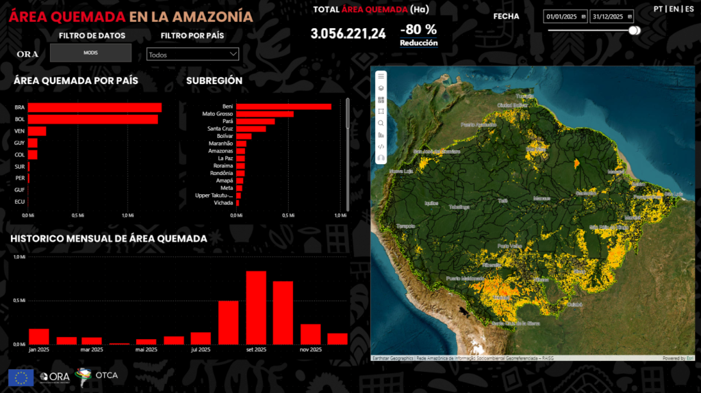
According to data processed by ARO for the eight Amazonian countries, around 15.5 million hectares burned in the Amazon in 2024. In 2025, this figure fell to just over 3 million hectares, representing a reduction of approximately 80%.
Burned area refers to the extent of land effectively affected by fire, characterized by the burning of large areas and changes in the structure of vegetation cover. These events generate direct impacts on biodiversity and Amazonian ecosystems.
“The total burned area is measured monthly through the spectral response captured by satellites,” explains Maycon Castro, an environmental monitoring specialist at ARO.
The new module expands the monitoring system already available through ARO, which also includes data on heat hotspots—thermal anomalies detected by satellites that may indicate the occurrence of fires—which also recorded a decline between 2024 and 2025.
“This information is important for Amazonian countries because it indicates locations where the forest is more exposed to pressures from deforestation or the uncontrolled use of fire to renew pastures,” explains Arnaldo Carneiro, ARO coordinator. “This helps countries plan their actions in these areas,” Carneiro adds.
Importance of the historical series
Although individual fire images can indicate their location and extent, experts emphasize that systematic monitoring over time is essential to understand fire dynamics.
“With a consolidated historical series, it is possible to identify, for example, whether a fire occurred in areas with recurring burning or whether it reached regions where fires had not previously been recorded,” Carneiro adds.
The data also reflect recent climate conditions in the region. The year 2024 was unusually dry and hot, which favored the spread of fires and contributed to the increase in burned areas. This situation was worsened by the historic drought that affected the Amazon between 2023 and 2024.
In 2025, rainfall patterns returned to levels closer to normal, helping to reduce the extent of burning across the region.
Beyond ecological impacts, forest fires also affect climate and human health. “Burned areas emit carbon, which worsens climate change, and release particulate matter that affects the health of people living in the region,” says Castro.
“With the new tool, managers, researchers, and decision-makers now have access to a more comprehensive database on fire dynamics in the region—an essential element for preventing fires, protecting biodiversity, and strengthening climate adaptation strategies,” Carneiro concludes.
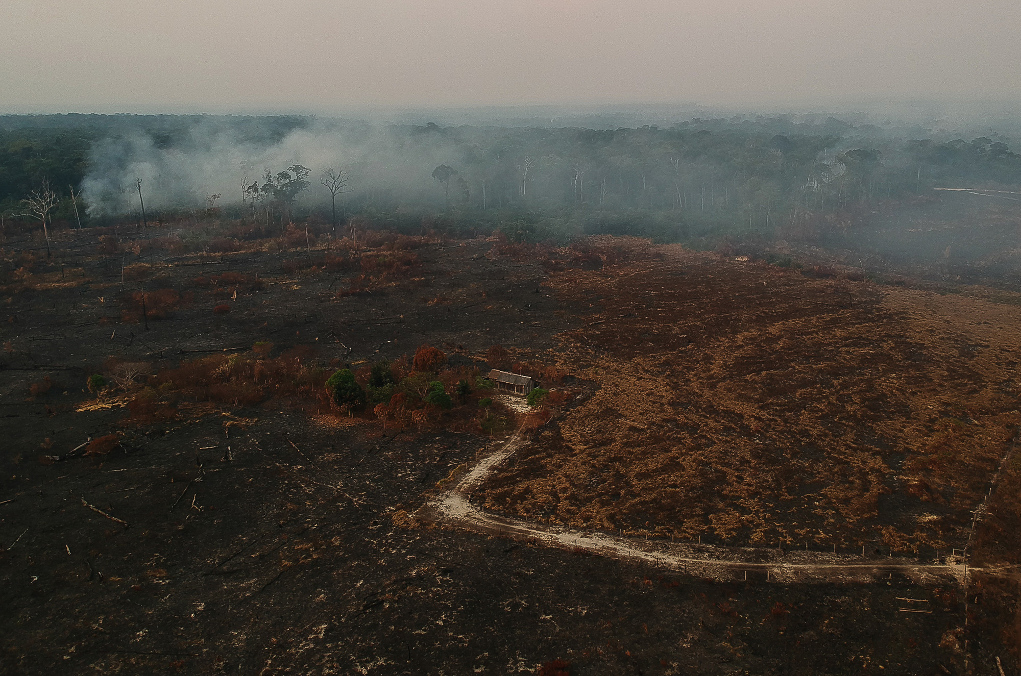
PHOTO: Area of deforestation and burning along the BR-230 highway in the municipality of Apuí, Amazonas, Brazil. Credit: Bruno Kelly/Amazônia Real.