The Amazon Basin recorded 23,998 hotspots in October 2026, an increase of 82.6% compared to the same month of the previous year. This rise occurred amid persistently high temperatures and below-average rainfall across much of the region. The findings are presented in the fourth edition of the Amazon Environmental Monitoring Bulletin, published by the Amazon Cooperation Treaty Organization (ACTO) through the Amazon Regional Observatory (ARO).
The Bulletin brings together data on precipitation, temperature, hotspots, and burned area across ACTO’s eight Member Countries, providing an integrated overview of environmental conditions in the Amazon Basin. This information makes it possible to track changes in these indicators, identify the most affected areas, and support environmental monitoring, prevention, and management efforts.
Below-average rainfall affects much of the Amazon
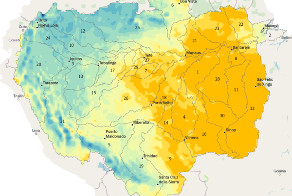
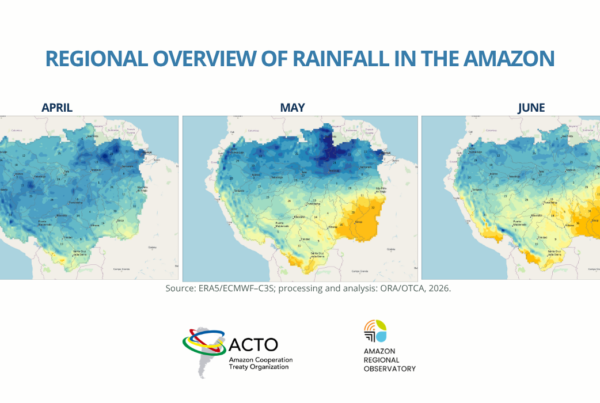
In October, approximately 73% of the Amazon Basin experienced negative precipitation anomalies, with the most severe deficits concentrated in the northern and central regions. Of the 32 sub-basins analyzed, 29 recorded dry conditions across more than half of their area.
Although rainfall increased in parts of the south-central Amazon compared to previous months, precipitation remained below the historical average across much of the region. The highest rainfall totals were concentrated in the western Amazon, particularly in the Marañón and Napo River sub-basins, while the lowest amounts were recorded mainly in the north and northeast.
Temperatures also remained high. The Amazon Basin’s average temperature reached 26.32°C, approximately 1.32°C above the historical average, marking the fourth consecutive month of above-average temperatures. The northern and east-central regions recorded the highest temperatures, with monthly averages ranging from 30°C to 32°C in some areas.
Hotspots increase, including in protected areas
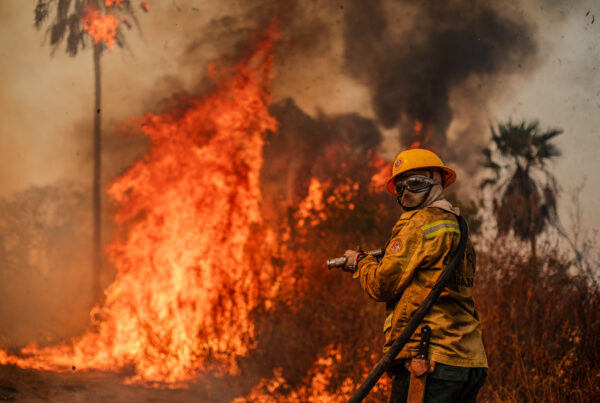
The increase in hotspots was one of the main findings of October’s monitoring. Detections were concentrated primarily in the east-central, southwestern, and southeastern Amazon. Between January and October 2026, a total of 72,864 hotspots were recorded, representing a 35.6% increase compared to the same period in 2025.
Forest formations accounted for 43% of the hotspots recorded during the year, followed by pastures, with approximately 28%. In October alone, monitoring identified 3,410 hotspots in Natural Protected Areas and 2,474 in Indigenous Territories, representing increases of 62% and 12%, respectively, compared to October 2025.
Persistent dry conditions and high temperatures may facilitate the spread of fires and intensify their environmental impacts. Smoke from fires also poses a concern for Amazonian cities, as it deteriorates air quality and increases health risks for local populations.
Burned-area data, available through August, also indicate an increase. A total of 13,430 km² was affected by fire during the first eight months of 2026, representing a 12.7% rise compared to the same period in 2025. Of this total, approximately 27% occurred in grassland formations, 26% in pastures, and 21% in forest formations.
Climate forecasts reinforce the need for continued monitoring
The conditions observed in October are particularly relevant in light of climate forecasts for the coming months. The El Niño 2026–2027 Panel, prepared by Brazilian federal institutions, including the National Institute of Meteorology (INMET), the National Institute for Space Research (INPE), and the National Center for Monitoring and Early Warning of Natural Disasters (Cemaden), indicated a higher probability of below-average rainfall and above-normal temperatures across much of northern Brazil between November 2026 and January 2027.
This outlook reinforces the importance of continuously monitoring environmental conditions in the Amazon, particularly the potential impacts on water resources, biodiversity, and local populations.
Environmental monitoring to support Amazonian cooperation
Published monthly, the ACTO Bulletin is part of the Amazon Regional Observatory’s initiatives to expand access to environmental information and strengthen technical cooperation among the Organization’s eight Member Countries.
The publication brings together data from different observation and monitoring systems, including precipitation and temperature data from ERA5/ECMWF-C3S, satellite-based hotspot detections, and burned-area data from the MODIS/MCD64A1 product.
By compiling and analyzing this information at the regional scale, the Bulletin contributes to a better understanding of environmental changes in the Amazon and provides technical evidence to support planning and decision-making related to biodiversity conservation, natural resource management, and environmental risk prevention.
Access the ACTO Bulletin and previous editions in the ACTO Library.
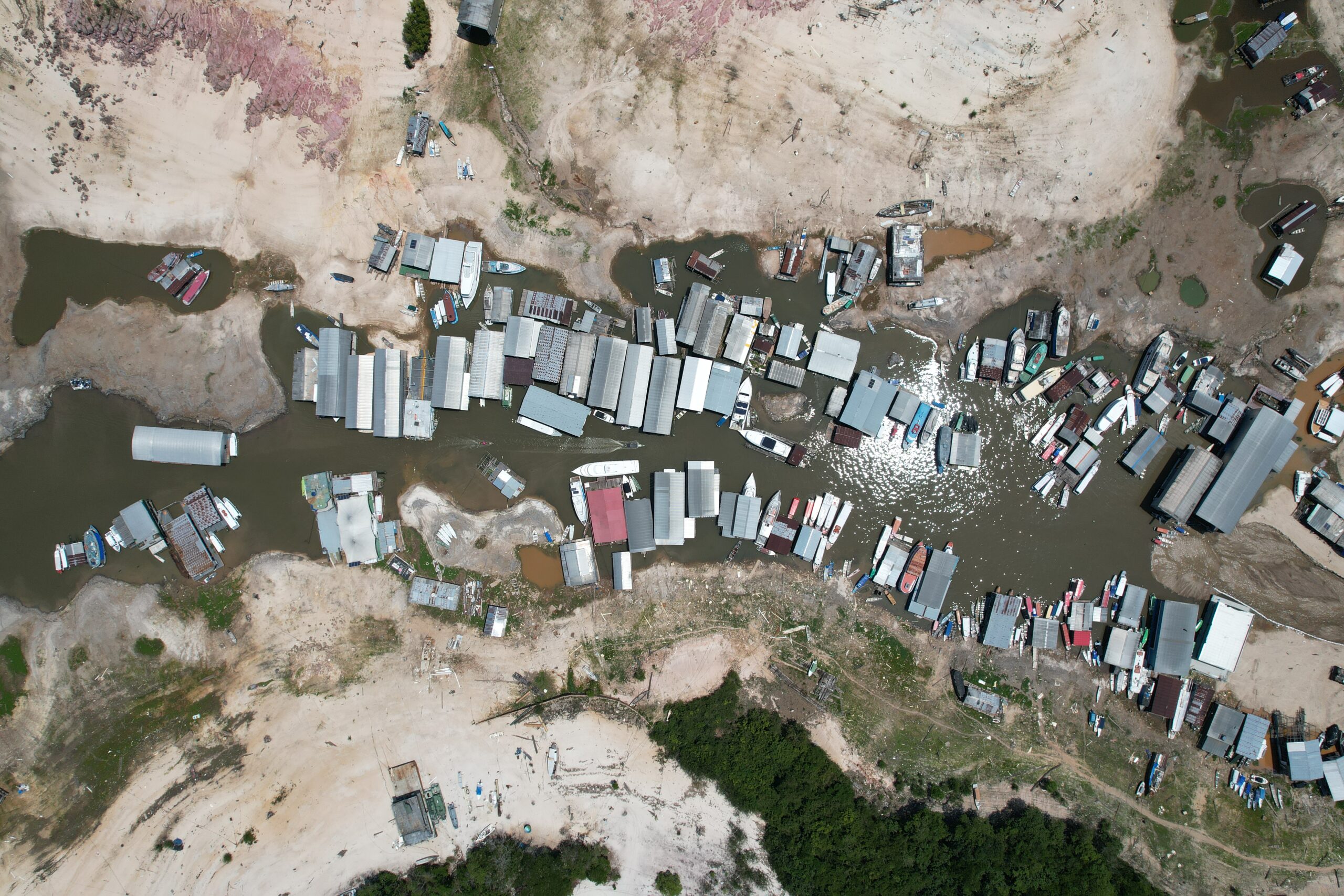
PHOTO: Taramã Açu- Manaus/AM, Brazil. Credit: Maycon Castro.