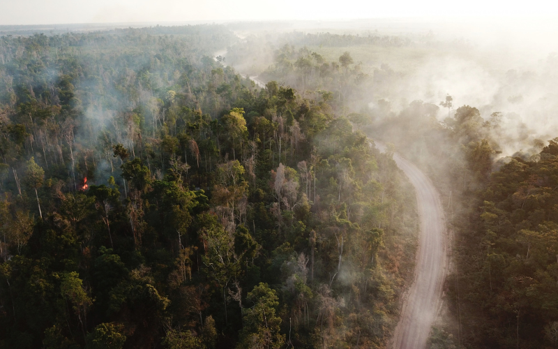
A forest can remain standing and still lose biodiversity, its capacity to store carbon, regulate water and provide other ecosystem services. This characteristic makes forest degradation more difficult to define and monitor than deforestation.
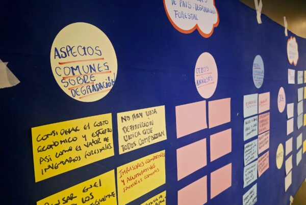
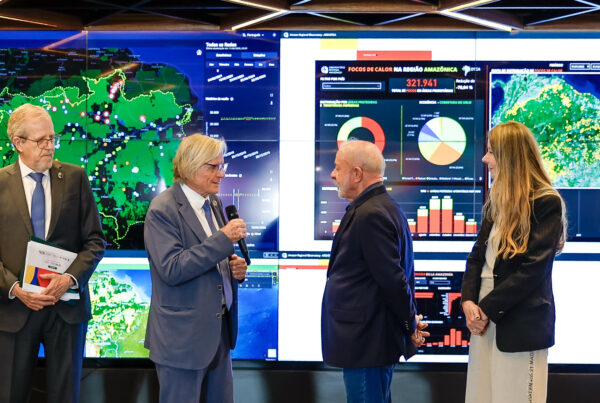
Different ways of understanding and measuring this process were discussed by experts from FAO, the World Bank, JRC, INPE and Brazilian universities during the Regional Meeting on Forest Degradation in the Amazon, held by ACTO and by the Amazon Network of Forest Authorities (RAFO) on August 27–28 in Brasília, with more than 60 participants.
According to FAO’s 2025 Global Forest Resources Assessment, 74 countries and territories have some form of definition of forest degradation. These definitions vary according to forest type, management objectives and the values attributed to ecosystems. The same change may be considered degradation when it entails biodiversity loss, but not necessarily when the criterion considers only the maintenance of timber production. “The wide diversity of definitions reflects not only differences among forest types, but also different perceptions, objectives and values associated with forests,” explained Xavier De Lamo of FAO.
This diversity has practical implications. Comparable systems require agreement on the reference state, which changes are considered significant and the spatial scale at which they will be measured. There are also differences regarding the causes considered, although, according to De Lamo, international discussions are moving toward an approach based on the effects observed on forests.
Another debate concerns the causes of degradation. Some definitions restrict degradation to impacts caused by human activities, while others consider the loss of forest structure or functions regardless of the origin of the disturbance. According to De Lamo, international discussions are increasingly pointing toward an approach based on the effects observed on forests, particularly because natural and anthropogenic factors may be increasingly interconnected.
Satellites expand the capacity to detect changes
Advances in remote sensing represent one of the most significant recent developments in forest degradation monitoring. Historical Landsat time series make it possible to reconstruct decades of forest change, while newer sensors, such as Sentinel-2, have significantly increased the frequency of observations.
INPE monitors degradation in the Brazilian Amazon through the Real-Time Deforestation Detection System (DETER), a near-real-time alert system designed to support enforcement and control actions related to deforestation, degradation and logging. For monitoring purposes, INPE understands degradation as a significant change in forest structure or condition caused by disturbances that do not necessarily result in its complete conversion to a non-forest area.
In practice, this definition is translated into features that can be identified in satellite imagery. DETER considers different manifestations of degradation, including chemical or seasonal degradation, forest-fire scars, selective logging and blowdowns associated with trees felled by strong winds. According to Alessandra Gomes of INPE, an important characteristic of degradation is its potentially temporary nature, as forests can follow different trajectories, recovering after a disturbance or undergoing further changes until they eventually reach clear-cutting.
René Beuchle of JRC presented another operational approach used by the Tropical Moist Forest (TMF), developed by the European Commission’s JRC. Using historical Landsat image series, the system has monitored tropical forests since 1990 and uses the duration of disturbances to distinguish among them. In TMF, changes lasting less than 900 days are classified as “degraded forest.” “What we call degraded forest means, in practice, that the disturbance period was short,” Beuchle noted.
These examples show how concepts of degradation need to be translated into observable criteria, while also illustrating the limitations of remote sensing. Satellites detect changes in vegetation cover and structure, but not necessarily changes in biodiversity and other dimensions of forest integrity. For De Lamo, remote sensing, field data and validation should therefore work in a complementary manner.
From diverse indicators to a common regional approach
Mariana Conte of the World Bank proposed looking beyond the physical structure of vegetation. In the review presented during the meeting, degradation was addressed as a loss of forest integrity, a concept organized into three dimensions: structure, functions and composition. The first considers characteristics such as canopy cover and complexity. The second incorporates ecosystem functions and services, including carbon storage and water regulation. The third encompasses forest composition and species diversity.
The review identified ten structural indicators, 24 functional indicators and five related to composition. Despite this variety, there is a significant imbalance in current monitoring capacity. Structural indicators are the most widely used, while functional aspects are only partially measured and biodiversity remains one of the main gaps.
“Adopting a forest integrity approach can be a good way to organize the indicators. But we need to close the gap between the major technological possibilities and what is done in practice,” Conte said.
This diversity does not necessarily require a single regional methodology. Alessandra Gomes suggested maintaining national systems, provided they are based on validated data and recognized methodologies, while developing a common legend that would allow results to be integrated at the Amazon scale. According to Gomes, this approach would enable the production of regional maps without replacing or compromising the monitoring systems already adopted by the countries.
The Amazon is already moving toward a regional vision
In the Amazon, part of this challenge is already beginning to be addressed by integrating information produced by ACTO’s eight Member Countries.
Joberto de Freitas, from the University of Brasília (UnB) and the Federal University of Amazonas (UFAM), presented preliminary results being developed for the second regional report on Amazon forests. The work combines national information with variables developed at the regional level, including temporary forest disturbances, developed using the FAO methodology for Forest Resources Assessment.
Between 2000 and 2024, the analysis identified 37.7 million hectares of forests that remained conserved in 2024 but had experienced some form of temporary disturbance during the period. Another 8.6 million hectares that were initially affected subsequently transitioned to deforestation.
The results reveal processes that a simple division between “forest” and “non-forest” cannot capture. “The definition is always a bottleneck,” Freitas acknowledged. According to him, regionalized information makes it possible to “look at the Amazon without internal borders” and create a common space for analysis.
As a follow-up to the meeting aimed at strengthening the monitoring and response to forest degradation across the eight Amazonian countries, Gian Pezo, Peru’s representative in the RAFO pro tempore presidency, proposed establishing a technical group to develop a regional glossary, comparable protocols and cross-border pilot projects, as well as to enhance data interoperability. “The Amazon does not need an imposed methodology, but rather a shared language, transparent parameters and comparable protocols that integrate remote sensing, field data and territorial knowledge,” Pezo concluded.
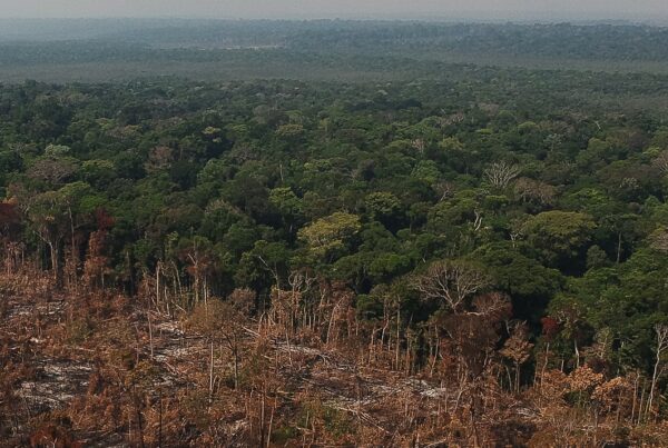
Photo: Fire in Paragominas (Brazil), 2017, by Clément Bourgoin (CIRAD/JRC).