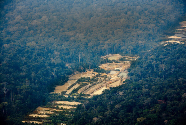
August 30,2016.- The Amazon Cooperation Treaty Organization (ACTO) will shortly present the third Regional Map of Amazonian Deforestation 2013-2014, developed within the Project: “Monitoring of Forest Cover in the Amazon Region”. The project uses national data provided by the Member Countries of ACTO which subsequently will be systematized in the Amazon Regional Centre of the National Spatial Research Institute (INPE) of Brazil. The first map was prepared with reference to year 2010 and the second 2013.
This is a pioneer initiative of regional technical cooperation in the forestry sector. The maps which were consolidated at regional level show the deforested area in a given period reporting amount of forest cover lost as well as the most affected places. These maps are tools for decision making to help ensure the conservation and sustainable management of forests. Currently, the Monitoring Project is preparing the fourth Regional Map 2014-2015 programmed to be published at the end of 2016.
Source: Monitoring Project/ACTO