The trilingual publication brings together regional data on rainfall, temperature, fire hotspots and burned areas across the eight Member Countries
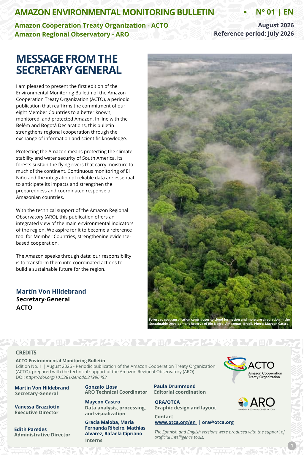
The Amazon Cooperation Treaty Organization (ACTO) has launched the first edition of the Amazon Environmental Monitoring Bulletin, a periodic publication produced with technical support from the Amazon Regional Observatory (ARO). Available in Portuguese, Spanish and English, the bulletin provides an integrated overview of the region’s environmental conditions and highlights trends that require monitoring in the coming months.
The publication brings together information on precipitation, temperature, fire hotspots and burned areas across the Amazon. The data are processed and analyzed at the regional level by ARO using recognized sources such as ERA5/ECMWF-C3S, Aqua-T/NASA/INPE and MODIS/MCD64A1.
The initiative contributes to fulfilling the commitments established in the Belém and Bogotá Declarations, which recognize the importance of producing and sharing scientific information to strengthen cooperation among ACTO Member Countries.
In his opening message, ACTO Secretary General Martín von Hildebrand emphasizes that continuous monitoring of El Niño and the integration of reliable data are essential to anticipate its impacts and strengthen the coordinated preparedness and response of the Amazonian countries.
“The Amazon speaks through data. Our responsibility is to transform these data into coordinated action to build a sustainable future for the region,” states the Secretary General.
Rainfall remained close to normal across much of the region
The first edition, published in August and covering July 2026, shows that approximately 75% of the Amazon Basin recorded rainfall within the climatological normal range. About 18.8% received less rainfall than expected, while 6.2% recorded above-average rainfall.
The lowest rainfall totals occurred in the southeastern Amazon Basin, particularly in the Juruena, Teles Pires and Xingu river sub-basins. In the northern and northwestern regions, the highest accumulations were observed in the Napo, Trombetas, Içá, Negro and Branco river sub-basins.
Although near-normal conditions prevailed, the bulletin identifies the expansion of an area with negative rainfall anomalies. The most pronounced deficits were recorded in the Uatumã-Nhamundá, Negro, Branco and Trombetas sub-basins.
The situation in the Negro River sub-basin requires special attention, as it showed a dry trend in February, April and July. If these conditions persist, they could affect river flows and soil moisture and create more favorable conditions for wildfires during the dry season.
In July, average rainfall in the Amazon Basin was approximately 90 millimeters, about 10 millimeters below the climatological average for the period.
Above-average temperatures spread across the Amazon Basin
The average temperature observed in July was approximately 24.68 °C, representing a positive anomaly of 1.18 °C compared with the historical average.
Maps covering the last three months show that temperature bands between 26 °C and 30 °C expanded mainly across the central, northern and eastern Amazon Basin, with a significant increase along the Santarém-Manaus axis.
The lowest temperatures remained concentrated in the western region, particularly in higher-altitude areas near the Andes.
Fire hotspots decreased in July but increased in the year-to-date total
In July 2026, 2,757 fire hotspots were recorded in the Amazon, a 38.5% reduction compared with July 2025. Of this total, 364 occurred in Natural Protected Areas and 542 in Indigenous Territories.
Despite the monthly reduction, the year-to-date figures showed a different pattern. Between January and July 2026, 19,991 fire hotspots were identified, a 12% increase compared with the same period in 2025. Of these records, 2,524 occurred in Natural Protected Areas and 2,340 in Indigenous Territories.
Forest formations accounted for the largest number of hotspots during the period, with 7,412 records, equivalent to 37% of the total. They were followed by pasturelands, with 4,926 hotspots, and grassland formations, with 3,102.
Burned area increased between January and May
The available burned-area data cover the period from January to May 2026. During these five months, the Amazon recorded 6,254 km² of burned area, a 38.8% increase compared with the same period in 2025.
Of this total, 850 km² occurred in Indigenous Territories and 720 km² in Natural Protected Areas. In May alone, 888 km² burned, an area 48.2% larger than that recorded in the same month of 2025.
Grassland formations accounted for the largest area affected by fire between January and May, followed by pasturelands, agriculture, floodable areas and forest formations.
Regional information to support decision-making
The Amazon Environmental Monitoring Bulletin was developed to expand access to information on the eight Member Countries and support the identification of trends, risks and areas requiring attention.
By bringing together data from different sources and presenting them from a regional perspective, the publication seeks to support decision-making, preventive action and coordinated responses.
Access the Amazon Environmental Monitoring Bulletin:
Portuguese version: https://otca.org/pt/publicacao/boletim-de-monitoramento-ambiental-n-1-ora/
Spanish version: https://otca.org/publicacao/boletin-de-monitoreo-ambiental-n-1-ora/
English version: https://otca.org/en/publicacao/environmental-monitoring-bulletin-of-the-amazon-n-1-aro/